
DIGITAL PHOTOGRAMMETRY
Era Mapping and Engineering offers high-precision mapping and modeling services with advanced technologies and expert staff in the field of digital photogrammetry. Digital photogrammetry is the process of creating a three-dimensional model of a land or structure using aerial photographs or drone images. This technology is particularly effective in measuring large areas, topographic mapping, land use planning and 3D modeling projects. Era Mapping and Engineering produces solutions with the highest accuracy and efficiency at every stage of your projects using digital photogrammetry techniques.
Data obtained with digital photogrammetry provides much faster and more accurate results than traditional measurement methods. Era Mapping and Engineering meticulously carries out all stages such as flight planning, image collection, processing and analysis of photographs.
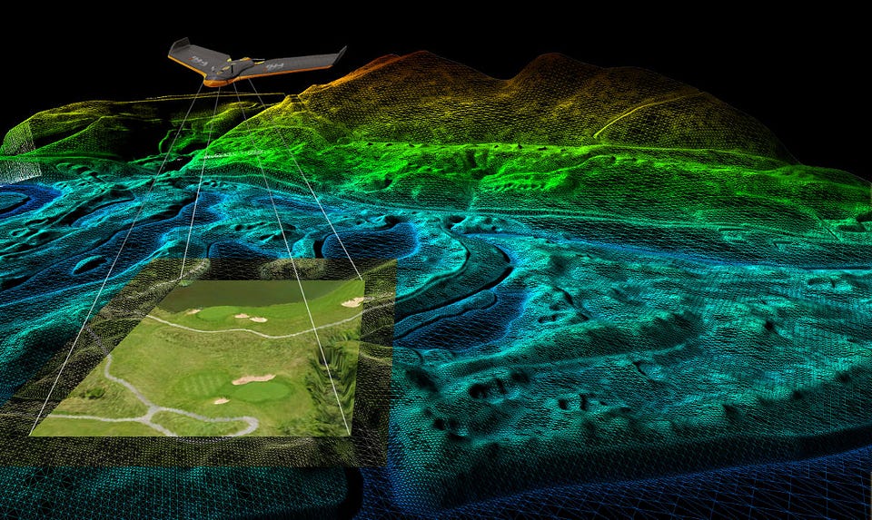
In this process, 3D modeling of the area is done using high-resolution cameras and modern photogrammetric software. These models provide an accurate representation of land surfaces, buildings, roads and other structures, making your projects more solidly based.
Digital photogrammetry also provides effective results in difficult and hard-to-access areas. Era Mapping and Engineering can collect data quickly and safely in areas that are physically difficult to access using drone technology. In this way, both time and cost advantages are provided, especially in large infrastructure projects, mapping, mining studies and similar projects. The precise data obtained with digital photogrammetry is used in every step from project planning to construction stages, ensuring that the process progresses more efficiently and without errors.